
Enabling The Vector Tile Output Format
This Section will teach you how to enable the mapbox vector tiles output format for a specific layer.
Navigate to the GeoServer Welcome Page.
Go to the Layers link at the left-hand menu and click on the topp:states.
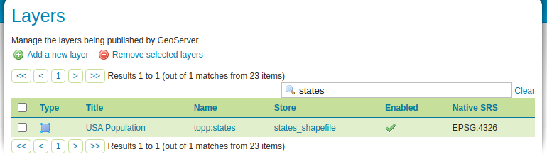
Selecting the “topp:states” layer
Select the Tile Caching tab and, if not enabled already, check the box labeled
Create a cached layer for this layer.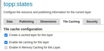
Showing the Tile Caching tab
Check the box labeled
application/vnd.mapbox-vector-tile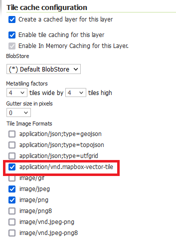
Save your changes to the layer.
You can check that the vector tiles are now available for the topp:states layer in the Tile Layers link at the bottom of the left-hand menu.
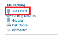
Showing the GeoServer Tiled layers
In the Tile Layers page, find the topp:states layer and from its preview options select
EPSG:900913 / pbf. This will open a preview of the layer in vector tiles with a basic style.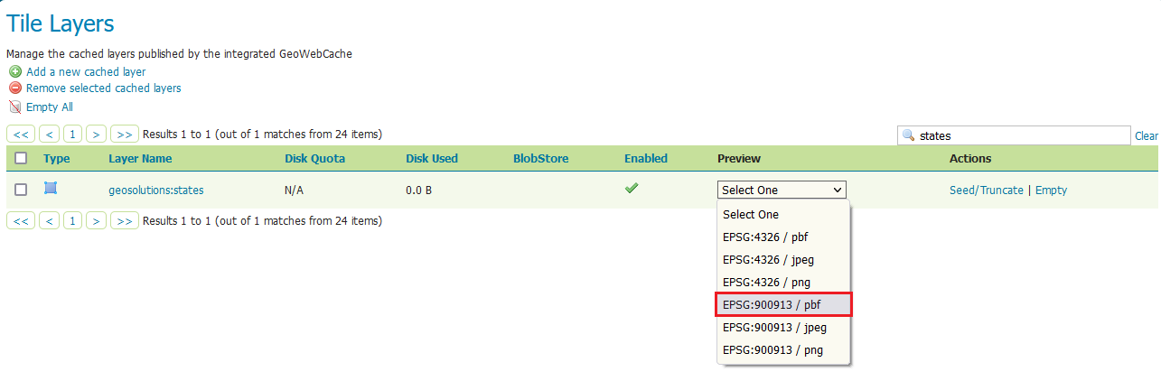
Open the preview for the states vector tiles
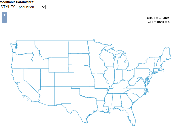
The vector tiles preview of the states layer