Adding a WFS Cascade Layer
GeoServer has the ability to load data from a remote Web Feature Service (WFS). This is useful if the remote WFS lacks certain functionality that GeoServer contains. For example, if the remote WFS is not also a Web Map Service (WMS), data from the WFS can be cascaded through GeoServer to utilize GeoServer’s WMS. If the remote WFS has a WMS but that WMS cannot output KML, data can be cascaded through GeoServer’s WMS to output KML.
Configuration
The configuration as usage of the cascaded layers follows GeoServer traditional ease of use.
Open the web browser and navigate to the GeoServer Welcome Page.
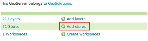
Select Add stores from the interface.
Select Web Feature Server (NG) from the set of available Vector Data Sources.
Specify a proper name (as an instance,
wfs-cascade) in the Data Source Name field of the interface.Specify
https://gs-stable.geo-solutions.it/geoserver/ows?service=wfs&version=1.0.0&request=GetCapabilitiesas the URL of the sample data in the Capabilities URL field.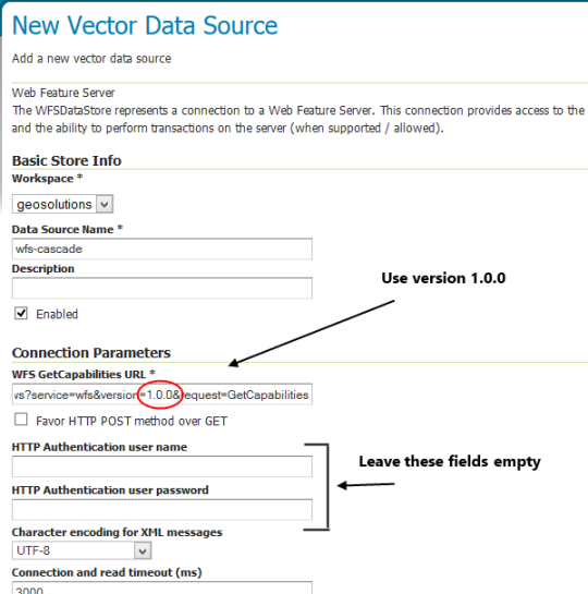
Make sure that the HTTP Authentication fields match the remote server authorization you have on it (In this case the server is open so we don’t need them).
Click Save.
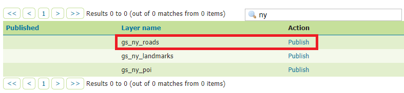
Publish the layer by clicking on the publish link near the gs_ny_roads layer name. Notice that you can also add more layers later.
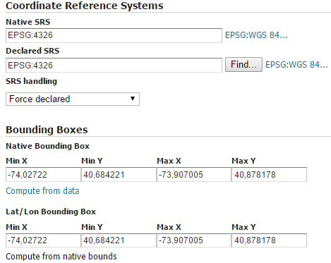
Check the Coordinate Reference Systems and the Bounding Boxes fields are properly set and click on Save.
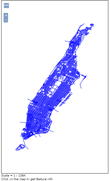
At this point the new WMS Layer is being published with GeoServer. You can use the layer preview to inspect the data.