GeoPackage Format
The GeoPackage is an open and standard format, portable and platform independent.
The format describes rules for storing geospatial data (vector and raster) within a SQLite database.
The format requires a SQLite database file with .gpkg extension.
Tables Overview
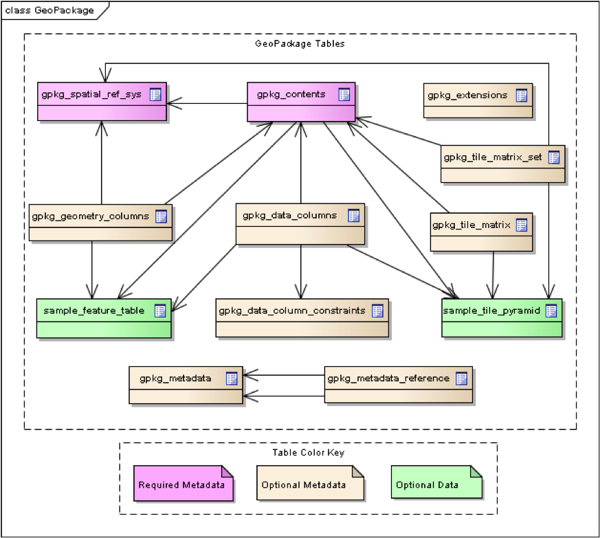
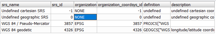
gpkg_spatial_ref_sys
This table contains records to define all spatial reference systems used by the table contents in the GeoPacakge itself.
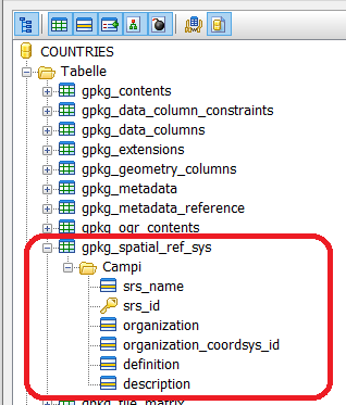
- Where:
srs_name: name of the SRS
srs_id: unique identifier for each SRS within the database
organization: name of the defininig organization
organization_coordsys_id: numeric ID of the SRS assigned by the organization
definition: WKT representation of the SRS
description: description of the SRS
gpkg_geometry_columns
This table identifies the geometry columns and geometry types in tables that contain user data representing features.
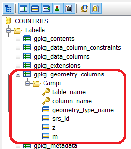
- Where:
table_name: name of the geometry table
column_name: name of the geometry column
geometry_type_name: name of the geometry type (eg. POINT, POLYGON)
srs_id: SRS ID of the data in the geometry column
z: enumerator for Z values (0: prohibited, 1: mandatory, 2: optional)
m: enumerator for M values (0: prohibited, 1: mandatory, 2: optional)

gpkg_contents
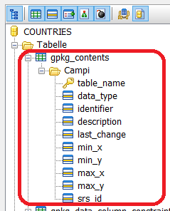
- Where:
table_name: name of the actual content table
data_type: type of the data stored in the table (eg. tiles, features, attributes) table
identifier: a short name identifier for the table_name content
description: a description for the table_name content
last_change: timestamp of the last change of the content
min_x: minimum Easting or Longitude for all content in the table
min_y: minimum Northing or Latitude for all content in the table
max_x: maximum Easting or Longitude for all content in the table
max_y: maximum Northing or Latitude for all content in the table
srs_id: Spatial reference System ID (referencing gpkg_sptial_ref_sys.srs_id)

gpkg_tile_matrix_set This table contains coordinates that define a bounding box as the exact stated spatial extent for all tiles in a tile (matrix set) table. If the geographic extent of the image data contained in tiles at a particular zoom level is within but not equal to this bounding box, then the non-image area of matrix edge tiles must be padded with no-data values, preferably transparent ones.
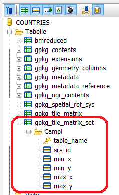
- Where:
table_name: name of the Tile Pyramid table
srs_id: Spatial reference System ID (referencing gpkg_sptial_ref_sys.srs_id)
min_x: minimum Easting or Longitude for the tile matrix set
min_y: minimum Northing or Latitude for the tile matrix set
max_x: maximum Easting or Longitude for the tile matrix set
max_y: maximum Northing or Latitude for the tile matrix set
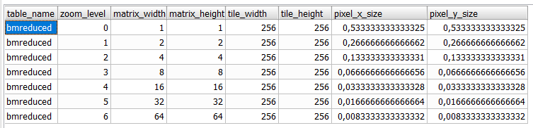
gpkg_tile_matrix
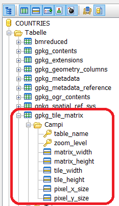
- Where:
table_name: name of the Tile Pyramid table
zoom_level: zoom level
matrix_width: number of columns for the specific zoom_level
matrix_height: number of rows for the specific zoom_level
tile_width: tile width in pixels for the specific zoom level
tile_height: tile height in pixels for the specific zoom level
pixel_x_size: width of the pixel in the table SRID unit (default meters)
pixel_y_size: height of the pixel in the table SRID unit (default meters)