Example n° 2: Serving a large number of DTM ASCII Grid Files
In this example there is a group of DTM images in ASCII Grid format. The purpose of this section is to describe how the GDAL commands may be used for merging the input files provided. These data are taken from Regione Calabria Open Data Portal at the ASCII - GRID section.
Note
On a Windows machine you can set-up a shell with all GDAL Utilities, running directly the file OSGeo4W.bat under the %TRAINING_ROOT% folder.
Note
Data have the same pixel resolution and same Coordinate Reference System EPSG:3003.
Warning
This example requires GDAL with Python bindings.
- Navigate to the workshop directory
$TRAINING_ROOT/data/user_data/gdal_processing_data(on Windows%TRAINING_ROOT%\data\user_data\gdal_processing_data) and find the DTM_data directory. - Navigate inside the DTM_data directory with the GDAL shell.
Note
The following operations must be executed from the shell inside the selected directory.
Calling the gdalinfo command on an image for retrieving the associated information:
gdalinfo 521150.asc
And the result is:
Driver: AAIGrid/Arc/Info ASCII Grid
Files: 521150.asc
Size is 193, 154
Coordinate System is `'
Origin = (2590740.000000000000000,4433860.000000000000000)
Pixel Size = (40.000000000000000,-40.000000000000000)
Metadata:
  AREA_OR_POINT=Point
Corner Coordinates:
Upper Left  ( 2590740.000, 4433860.000)
Lower Left  ( 2590740.000, 4427700.000)
Upper Right ( 2598460.000, 4433860.000)
Lower Right ( 2598460.000, 4427700.000)
Center      ( 2594600.000, 4430780.000)
Band 1 Block=193x1 Type=Float32, ColorInterp=Undefined
  NoData Value=-9999
From gdalinfo it is possible to note:
- No CRS definition. An image without CRS cannot be displayed on GeoServer.
- Tiles Striped (193x1).
- No Compression.
Listing of all the images into a single text list with the following command:
ls *.asc > list.txt (Linux)

or

dir /b *.asc > list.txt (Windows)
Merging of all the input files with the gdal_merge.py command:
(Linux)
gdal_merge.py -o merged.tif -co "TILED=YES" -co "BLOCKXSIZE=512" -co "BLOCKYSIZE=512" -co "COMPRESS=DEFLATE" -co "ZLEVEL=9" -co "BIGTIFF=YES" -init -9999 -a_nodata -9999 -n -9999 -ot Float32 --optfile list.txt

or

(Windows)
gdal_merge -o merged.tif -co "TILED=YES" -co "BLOCKXSIZE=512" -co "BLOCKYSIZE=512" -co "COMPRESS=DEFLATE" -co "ZLEVEL=9" -co "BIGTIFF=YES" -init -9999 -a_nodata -9999 -n -9999 -ot Float32 --optfile list.txt
Note
This command must be executed with python for avoiding import errors.
Parameters used:
-o merged.tif : definition of the output file name.
-co “TILED=YES” -co “BLOCKXSIZE=512” -co “BLOCKYSIZE=512” : definition of tile dimensions.
-co “COMPRESS=DEFLATE” -co “ZLEVEL=9” -co “BIGTIFF=YES” : definition of the compression mode.
Note
-co “BIGTIFF=YES” is used because GDAL is not automatically able to convert the GeoTiff image into a BigTiff if compression is set.
-init -9999 : initialization of the image pixels to NO DATA.
-a_nodata -9999 : definition of the output value for NO DATA.
-n -9999 : definition of the input pixel value to ignore during merging.
-ot Float32 : definition of the image output type.
–optfile list.txt : definition of the input file list.
The gdalinfo output on the merged image is:
Driver: GTiff/GeoTIFF
Files: merged.tif
Size is 3613, 6284
Coordinate System is `'
Origin = (2570700.000000000000000,4445900.000000000000000)
Pixel Size = (40.000000000000000,-40.000000000000000)
Image Structure Metadata:
  COMPRESSION=DEFLATE
  INTERLEAVE=BAND
Corner Coordinates:
Upper Left  ( 2570700.000, 4445900.000)
Lower Left  ( 2570700.000, 4194540.000)
Upper Right ( 2715220.000, 4445900.000)
Lower Right ( 2715220.000, 4194540.000)
Center      ( 2642960.000, 4320220.000)
Band 1 Block=512x512 Type=Float32, ColorInterp=Gray
  NoData Value=-9999
The merged image has a good tiling(512x512) and compression, but the CRS is still undefined.
Setting of the image CRS with gdal_translate:
gdal_translate -a_srs "EPSG:3003" -co "TILED=YES" -co "BLOCKXSIZE=512" -co "BLOCKYSIZE=512" -co "COMPRESS=DEFLATE" -co "ZLEVEL=9" -co "BIGTIFF=YES" merged.tif merged_CRS.tif
The various input parameters are maintained because by default GDAL do not compress the input image and set a bad tiling.
From gdalinfo:
Driver: GTiff/GeoTIFF
Files: merged_CRS.tif
Size is 3613, 6284
Coordinate System is:
PROJCS["Monte Mario / Italy zone 1",
        GEOGCS["Monte Mario",
                DATUM["Monte_Mario",
                        SPHEROID["International 1924",6378388,297.0000000000014,
                                AUTHORITY["EPSG","7022"]],
                        TOWGS84[-104.1,-49.1,-9.9,0.971,-2.917,0.714,-11.68],
                        AUTHORITY["EPSG","6265"]],
                PRIMEM["Greenwich",0],
                UNIT["degree",0.0174532925199433],
                AUTHORITY["EPSG","4265"]],
        PROJECTION["Transverse_Mercator"],
        PARAMETER["latitude_of_origin",0],
        PARAMETER["central_meridian",9],
        PARAMETER["scale_factor",0.9996],
        PARAMETER["false_easting",1500000],
        PARAMETER["false_northing",0],
        UNIT["metre",1,
                AUTHORITY["EPSG","9001"]],
        AUTHORITY["EPSG","3003"]]
Origin = (2570700.000000000000000,4445900.000000000000000)
Pixel Size = (40.000000000000000,-40.000000000000000)
Metadata:
  AREA_OR_POINT=Area
Image Structure Metadata:
  COMPRESSION=DEFLATE
  INTERLEAVE=BAND
Corner Coordinates:
Upper Left  ( 2570700.000, 4445900.000) ( 21d25'57.43"E, 39d29'28.80"N)
Lower Left  ( 2570700.000, 4194540.000) ( 21d 3'12.94"E, 37d16'39.68"N)
Upper Right ( 2715220.000, 4445900.000) ( 23d 3'58.08"E, 39d18' 6.80"N)
Lower Right ( 2715220.000, 4194540.000) ( 22d38'27.42"E, 37d 6' 9.29"N)
Center      ( 2642960.000, 4320220.000) ( 22d 2'40.73"E, 38d17'47.75"N)
Band 1 Block=512x512 Type=Float32, ColorInterp=Gray
  NoData Value=-9999
This image can be displayed on GeoServer but a further optimization step could bring to better performances.
(Optional) Creation of the overviews associated to the merged image for having better throughput:
gdaladdo merged_CRS.tif 2 4 8 16
Overviews are reduced views of the input image used by GeoServer for displaying the image at a lower resolutions.
And with gdalinfo:
Driver: GTiff/GeoTIFF
Files: merged_CRS.tif
Size is 3613, 6284
Coordinate System is:
PROJCS["Monte Mario / Italy zone 1",
        GEOGCS["Monte Mario",
                DATUM["Monte_Mario",
                        SPHEROID["International 1924",6378388,297.0000000000014,
                                AUTHORITY["EPSG","7022"]],
                        TOWGS84[-104.1,-49.1,-9.9,0.971,-2.917,0.714,-11.68],
                        AUTHORITY["EPSG","6265"]],
                PRIMEM["Greenwich",0],
                UNIT["degree",0.0174532925199433],
                AUTHORITY["EPSG","4265"]],
        PROJECTION["Transverse_Mercator"],
        PARAMETER["latitude_of_origin",0],
        PARAMETER["central_meridian",9],
        PARAMETER["scale_factor",0.9996],
        PARAMETER["false_easting",1500000],
        PARAMETER["false_northing",0],
        UNIT["metre",1,
                AUTHORITY["EPSG","9001"]],
        AUTHORITY["EPSG","3003"]]
Origin = (2570700.000000000000000,4445900.000000000000000)
Pixel Size = (40.000000000000000,-40.000000000000000)
Metadata:
  AREA_OR_POINT=Area
Image Structure Metadata:
  COMPRESSION=DEFLATE
  INTERLEAVE=BAND
Corner Coordinates:
Upper Left  ( 2570700.000, 4445900.000) ( 21d25'57.43"E, 39d29'28.80"N)
Lower Left  ( 2570700.000, 4194540.000) ( 21d 3'12.94"E, 37d16'39.68"N)
Upper Right ( 2715220.000, 4445900.000) ( 23d 3'58.08"E, 39d18' 6.80"N)
Lower Right ( 2715220.000, 4194540.000) ( 22d38'27.42"E, 37d 6' 9.29"N)
Center      ( 2642960.000, 4320220.000) ( 22d 2'40.73"E, 38d17'47.75"N)
Band 1 Block=512x512 Type=Float32, ColorInterp=Gray
  NoData Value=-9999
  Overviews: 1807x3142, 904x1571, 452x786, 226x393
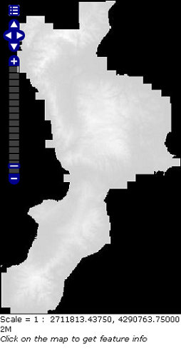
Then the result can be displayed in GeoServer by configuring the image as a GeoTiff (see Adding a GeoTiff section).
Displaying the result on GeoServer: